Imagine if you combined your favorite mapping software with chat functions, streaming video and the ability to control killer robots. That would get you partway to what Team Awareness Kit offers.
Developed by the Air Force Research Laboratory beginning in 2010, the Android Team Awareness Kit or ATAK was an Android-based continuation of previous flight planning software development. By 2017, it had become the U.S. Army standard software for their digitized soldier program called Nett Warrior.
There are now multiple versions of ATAK out, and it’s no longer restricted to just the Android platform. In fact, the program office that handles development of the system is now simply referred to as TAK.
Essentially a Geospatial Information System, or mapping software, TAK displays geotagged data sets in relation their location on the map. Mapping data can be government or commercial and raster- or vector-based, and includes mensurated images such as satellite imagery, allowing users to “zoom in” to an area of interest. It also offers encrypted data communication such as text and file sharing (including photos and video). Additionally, when used on a GPS-enabled device, it will display the user’s current location and share it with others, if enabled. Entire groups can keep track of one another and conditions around them, enhancing command and control. Hence the name Team Awareness Kit.
TAK can also be configured for flight or route following when used on a GPS-enabled device. Depending on the level of GPS precision, TAK can be used for targeting. Symbology used by DoD includes military symbology, customized symbols such as icons from Google Earth, and Google Maps for iconography as well the Cursor on Target data format standard for communication. Because the data protocol is embedded in the software, TAK is adaptable to different devices and networks, allowing them to talk to one another. The interface is quite intuitive, particularly for younger users.
After development, it was quickly adopted across DOD, by air, ground and maritime users. As of last year, there are more than 250,000 users across the U.S. government, and TAK is used in 15 government programs, with more being added all of the time. It has become particularly useful in controlling remote systems such as drones and robots.
In fact, the Department of Defense offers versions of TAK for use by allied forces in order to establish a common operation picture and help deconflict between friend and foe as well as other battlefield information.
What makes this software so significant is that it has taken on a life all its own. Though it was initially restricted to just Department of Defense customers, its utility was soon realized by multiple user groups.
For example, a version of TAK has been used by the Fire Service to enhance situational awareness of where firefighters are located as well as the hazards of the fire around them, in real time.
Now, there’s even a PC-based version of TAK-CIV called WINTAK, which was used to manage the various agencies supporting the recent presidential inauguration.
Some of the currently available versions available are listed below with their current naming conventions. Some versions are controlled distribution due to International Trafficking in Arms Regulations.
TAK-MIL (military sensitive version for U.S. and foreign military end-users)
TAK-GOV (restricted version of the TAK product line for U.S. and foreign government entities)
TAK-CIV (distribution-controlled but fully releasable version of the TAK product line for first responders and software developers)
iTAK (TAK connected tool for iOS)
WINTAK (Windows-based version of TAK)
A software development kit is also available.
For a short time, there was also a version available called TAK-PR, which was for public release for non-governmental use. It was not plug-in compatible, and distribution was halted last year.
As seen above, the Department of Homeland Security asked for the software to be ported over to iOS. Once this is opened to non-governmental users, TAK will explode in popularity.
Once fully available to civilian users, TAK offers the same advantages as their government counterparts. There’s a common geospatial baseline with multiple means to communicate and share information. For example, imagine researching a vacation and having access to photos and trip reports from multiple users directly from a map. What’s more, it would be possible to engage the creators of those records directly or even someone currently at that location if they enable contact.
Now that you know about TAK, let’s look at opportunities for the shop owner in the shooting, hunting and outdoor space.
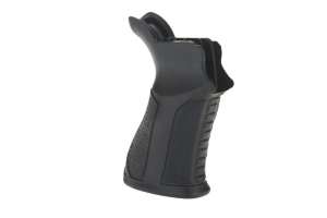
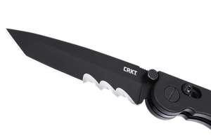
While you probably won’t sell the handheld devices, which are required to run a version of TAK, there are accessories such as cases for those devices that offer mil-spec environmental and impact protection. An extension of these cases are mounts for vehicles and personnel, the latter of which can include mounts to equipment, such as armor vests as well as kneeboards and wrist mounts, so the user can easily see the data on the screen.
There’s another burgeoning opportunity for those of you who can code: TAK accepts plug-ins. In fact, the U.S. Army set up a DoD-only website that allows soldiers who use TAK to download plug-ins they require in a manner that is similar to what iTunes App Store or Google Play is like. Likewise, Special Operations Command, which stood up an office dedicated to software last year, is working on something similar.
The business model they are working toward is like the Apple and Google models, with the developer paid for each download.
But those opportunities are a drop in the bucket when compared to what will happen once TAK becomes more common among civilian users. If you are familiar with the volume at which apps on iOS and Android are sold, you can see the opportunity.
The best resources for all things TAK-related are TAK.gov or TAKmaps.com. Take some time to familiarize yourself with the software and give it a try.
Photo courtesy of Defense Threat Reduction Agency's Chemical and Biological Technologies Department